North Kyoto Cycling Route – Rider Stories
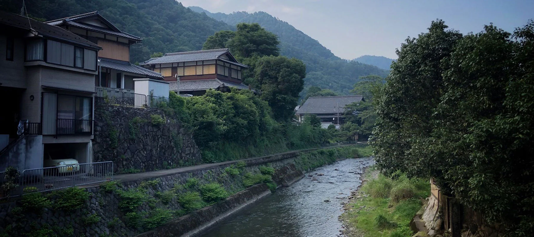
The mountains in the north of Kyoto are special – giant cedar trees, picturesque Japanese houses and farms, rivers and streams flowing from town to town and mountains with almost endless winding roads.
Imagen de Giuseppe Ciaola
Ruta
No es demasiado largo, 40 km, pero es más que suficiente para hacer un buen ejercicio. La mayor parte de la ruta transcurre por senderos fluviales y carreteras de montaña, con algunos tramos por los suburbios del norte de Kioto.
Distance: 40.27km
Elevation: 474m
Access from Kyoto city: Good (This is one variation on the North Kyoto Hills loop which can be extended upwards of 75km all started from RBRJ Kyoto’s location)
Ciclista

#RideNowRaceTeam
Giuseppe lives in Shanghai where he is an active member of the growing cycling community in China. When he travels he loves getting out on the bike, attacking the local surroundings and capturing parts of it with breathtaking photos. Most of the photos in this blog were taken by Giuseppe and we thank him for letting us share them with you.
Giuseppe went for two rides in Kansai and this is one of them. His other ride was an epic 140km loop down to Nara and back in searing summer temperatures.
We decided to feature his 40km ride because we think it offers so much for all levels of cyclists in Kyoto. Giuseppe had a bit of extra time in the afternoon so jumped on the bike, got his ride in and was back to enjoy his evening in beautiful Kyoto. We’re all short on time which is why we love Giuseppe’s route and we’re sure you will too.
Bicicleta en ruta

RBRJ now offers the Cannondale Optimo 1 as an updated option
Inicio del río Kamo
La ruta comienza en el famoso río Kamo, que atraviesa la ciudad de norte a sur. El río cuenta con excelentes carriles bici y de footing con cuidados jardines y es un río estupendo para explorar en bicicleta.

Los habitantes de Kioto también son aficionados al río: la gente hace footing, ejercicio, juega al fútbol y, en general, disfruta del ambiente y el espacio fluviales.
La ruta comienza en la estación de Sanjo y se dirige hacia el norte. Continúe hasta que el río se divida en dos y tome el camino de la derecha, que le llevará por el río Takano.

Río Takano y hacia la montaña
Siga el río más allá del parque del estanque de Takaragaike y siga el río mientras da la vuelta a la derecha, cerca de la estación de Takaragaike.

Pasará volando la última parte de la ciudad antes de empezar a adentrarse en las montañas y el bosque. La carretera empieza a subir poco a poco y te deleitarás con los sonidos, olores y vistas de la naturaleza.

Hay algunos templos y santuarios salpicados a lo largo de la carretera de montaña en los que se puede parar y echar un vistazo o simplemente seguir pedaleando y disfrutar de las vistas desde la bicicleta.
Oharanomuracho giro a la izquierda
Siga subiendo por la 367 que bordea el río Takano hasta llegar a una zona llamada Oharanomuracho donde girará a la izquierda por la 40.

El paisaje de Oharanomuracho es precioso, con casas tradicionales a orillas del río que permiten disfrutar de unas buenas vistas desde la bicicleta.

Elevación
A medida que te adentras en la carretera número 40, la elevación empieza a aumentar, lo que te da la oportunidad de quemar algo de energía y encontrar un buen ritmo. La pendiente dura unos 2 km y alcanza el 9,7%, lo que sin duda hará trabajar el corazón y los pulmones.

After the peak of the small climb you’ll start descending down the winding road through the mountain.
La carretera número 40 se desvía hacia la izquierda al pasar la estación de Ichihara, pero hay que seguir recto para llegar a la carretera número 38.

You’ll pass through an area called Shizuichiichiharacho as you make your way back towards the suburbs of Kyoto.

Río Kamo, Kamigamo y final
It’s here you’ll link back onto the Kamo river as you head south towards Kamigamo and into the northern Kyoto suburbs. The north of Kyoto is a lovely place with lots greenery, mountains to the west, north and east, and also some great cafes to stop at for a coffee or a spot of lunch. The route will then turn left and head along the north side of the Kamigamo golf club as you make your way east to join back onto the Takano river that you started on.

Disfrute del paseo final a lo largo del río Takano y luego del río Kamo mientras regresa al centro de Kioto para terminar la ruta.
Reflexiones finales
You won’t be disappointed taking your bike into the mountains north of Kyoto city. If you’re looking for a medium length ride with stunning scenery then we recommend trying Giuseppe’s route. He had a great couple of days riding around Kyoto (and Nara) and we appreciate him letting us share his route and photos on our blog. How about you? Do you have any favorite routes around Kyoto? We’d love to hear about your experiences cycling around Kyoto, the cultural capital of Japan.
